Showing posts with label sky friday. Show all posts

Friday, September 3, 2010

Sky Friday - cloud panoramas

If you've ever taken a series of photographs and used software to stitch them together into a panorama shot, you know how addicting creating "panos" can be.

Back when I had PS Elements 4.0 on my old PC, I used that pano stitching program, but found it a bit time-consuming and it had major limitations and shortcomings, like a really poor blending tool and frequent error messages about not enough memory to complete the task that seemed to take forever.

I still haven't purchased the latest edition of Elements, but recently started taking some pano series shots for the time when I had the software available again.  Then, on a whim, I decided to do a search for "panorama software, iMac", and read some reviews.

Written by a Danish software engineer (I assume that's his title) called "Double Take" came up as an easy-to-use, stand-alone stitch program.  And, you could download a trial version of it for free.  The registered version is only $24.95, which seemed like a deal if it worked well.  The official site is here, where you can read more, download and/or purchase the program.

Anyhow, I tried it on a set of photos I took a few weeks ago on one our hikes, and was amazed at: 1) how simple it is to use; 2) how well it works.  I'd previously tried Hugin, which is a free Linux-based stitching software, based on a review by Ken Rockwell, but I couldn't get it to do anything, and it was far more complex and confusing than I wanted.  Double Take, on the other hand, is simple yet has features that make it vastly superior to the pano program in Elements.  Even when I do get around to purchasing Elements, I'll keep using Double Take for all panos.

* You open up a new file and literally drag and drop as many photos, one at a time, as you want.  The program automatically matches up each one as you drag it.  You can then re-adjust each if needed.  I found the program did a better job than I did.

* You can then edit each one to adjust for exposure, gamma, saturation, brightness and contrast, and correct the geometry of each, if needed, for rotation, pitch and scale.  You can also select it to crop automatically and lock each stitch into place.

In short, it is great.  I ended up ditching all my previous pano shots made in PS Elements and re-did them in DT, in a fraction of the time, with far better results.

Since then, I've gone on a bender with the pano shots.  Even with my zoom lens that allows for wide-angle shots, I still find that a two-shot pano gives more detail and will allow for a bigger size, should I ever care to print it, than a single wide-angle shot.

So, this Sky Friday features several sky panos.  Locations vary, but most were shot on my deck.  All are two-shot panos.  I should also add that most of these were shot in RAW format, and the program handles that just fine, probably as iPhoto jpeg conversions.

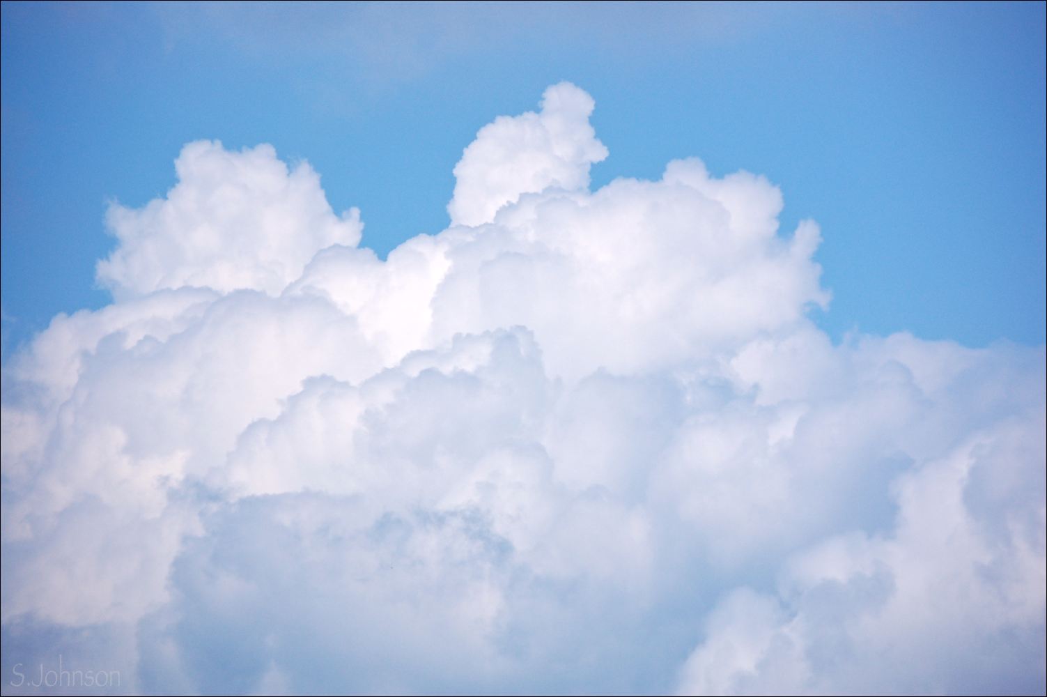
Cumulus congestus afternoon 
August 29, 2010

Stratocumulus sunset
August  30, 2010

Cumulonimbus over Perins Peak
August 25, 2010

Sunset and fading storm
August 25, 2010

Virga over Horse Gulch
August 29, 2010

Altostratus sunset
August 27, 2010

Friday, August 20, 2010

Sky Friday: July 27 sunset

One of the many, many perks about where we live is that the deck from our bedroom faces due west.  The sun sets in the center of the bowl formed by Smelter Mtn. to the south and Perins Peak to the north.  Being in monsoon season, the evening sky is often covered with stormclouds, either coming or going, so we haven't been getting too many colorful sunsets.

Going back through the photos I've taken, I realized that this set, taken on July 27, was one where we had some good color going on.  We had a simply amazing sunset 2 nights ago; that will be for another day.

Sunrises and sunsets were something I never saw from our place in CT.  In fact, I never saw a single sunrise the entire time I lived there.  Sunsets I saw on rare occasion; you had to make a special effort to go somewhere to see them, where trees and buildings weren't totally obscuring the view.

Now that I have a "deck with a view", it means I'm grabbing my camera a lot.  Incidentally, these were all shot with my 8-y.o. Olympus 3.1MP p&s, since my DSLR lens didn't have any wide angle capacity.  It takes surprisingly good photos given its age and small sensor size.   Good news is that I purchased a much higher end lens from eBay (used, and less than half of what the same lens costs new) that's a much broader zoom - 18-70mm.  I could tell the difference in the quality of the lens, the glass, and the resultant photos immediately.  

Coming into the light

Over Smelter Mtn.

Sunset diffusion with tree 

Final light


Saturday, August 14, 2010

A belated Sky Friday (or: Sky Saturday)

Well, I'd meant to post these yesterday, but then, we left for a hike up in the mountains that took up most of our day.  With all good intentions, I was going to post them after I got back.  But, between a poor nights' sleep and a ~8 mile hike at 10,000' elevation with 1,700' up and down...I was a bit tired.  Add a beer to that, and I was done for the night.

Anyway, I've been wanting to post these - they are a small sampling from our drive across the country.

One from several of the states we drove through (not counting CT, NY, NJ, IN or IL, as nothing interesting going on in the sky there).  These are all "sky only" photos, lending them that abstract feeling that I am so fond of.  All were taken while driving and usually at the shortest focal length my lens allows:  55mm.  I've missed my wide-angle lens so much that I finally broke down and bought a used Nikkor 17-70mm DX on eBay.  It gets good reviews, and will be my landscape/walkabout lens.  It should arrive sometime next week.

Shown from east to west:

Pennsylvania
Morning light creates dark edges on this huge cumulus cloud top, giving an appearance of large cottonballs with lavender and pink tints

Ohio
Mid-afternoon, south of Cleveland and north of Akron, light defines the texture of this cumulus cloud system

Iowa
Higher altocumulus clouds are in the background, while more cumulus take up most of the sky


Nebraska
Loose clouds form vertical and horizontal shapes in the near sky, while higher cirrus form an edgeless background, muting the blue of the sky


Colorado
Near the I-80/I-76 junction northeast of Denver, this pair of contrasting clouds forms an unusual shape

Sky Fridays to resume on their usual day next week.

Friday, July 30, 2010

Sky Friday - A Colorado Sunset

Whew - today is the first day I've had access to my computer since our move (our stuff arrived yesterday, and we spent yesterday and today unloading it...glad that is over), and I was finally able to download the 1300+ photos I took since we left.  And, happily, can resume posting here.

Our drive across the east and midwest was an epic journey; I am hoping to do a post of it that will be quite long, with photos, in the next few days.  Most were shot through the passenger window of the Civic as we traversed the country along I-80, and many of them were - you guessed it - clouds!   So many amazing clouds during the drive, and it just got better after we got to CO.   For our arrival into Durango, we were greeted with one of the glorious monsoon storms that both Wayne and I have missed so much.

Since being here almost a week, we've gone out on drives and/or hikes almost every day, which has afforded me a rich assortment of photos of more monsoon skies, both in the mountains and along the plateau country south and west of Durango.  

Since it's been a while for any sunset photos, this Sky Friday resumes with some photos we took on a drive out on Monday, July 26.  The skies looked promising for a great sunset, so we headed south and east of town to get a more open view.

We drove down a dirt road that was surrounded by farmland, with mountains of the Rockies in the distance, and pulled off for some photos.  The mosquitos were a bit out of hand, due to the nearby irrigation ditch, so we didn't stay too long.

Here is the first of many Sky Friday posts of the beautiful skies of southwestern CO.  Enjoy, and thank you for your patience with the long delay in posts.

To the east
The face of the mountains captures the glow of the setting sun, while the cumulonimbus

To the north
Beautiful shades of purple- and blue-grays begin to infuse these stratocumulus clouds 

To the west
The sun silhouettes the stratocumulus clouds, while the San Juan Mtns. taper away to plateau country to the right

Back to the east
Cattle graze on the lush pastureland while the cumulonimbus continues to change in both shape and color

Farm with sunset
A building silhouette is dwarfed by the adjacent trees and colorful clouds in this view to the northwest.  The San Juans are visible in the left

To the south
A look down the dirt road leads to classic Colorado Plateau country, and the pink-purple clouds are remnants of earlier monsoon storms that are now fading away along with the light.

Friday, July 16, 2010

Sky Friday - Colorado skies

It is now only four days before we depart from the east coast begin our 2248 mile trip to our final destination of Durango, CO.   To say that I am excited is a bit of an understatement; we have been planning this move for 4 years.  I leave behind some wonderful friends I made through my two jobs, and they are what I will miss about living here.

Given our impending move, a Colorado-based Sky Friday seemed apropos.  Last year, Wayne and I spent almost a week there, and of course, I came away with hundreds of photos.  These photos are as much about the sky as the land...what can I say?

On August 2, we took a day-long drive encompassing highways 550, 62, 145 and 160.  The loop offers some of the most spectacular scenery in the state.  It passes through several scenic mountain towns, then drops down into a valley, passing through the towns of Dolores and Mancos, and then back east through Hesperus before returning to Durango.

Monsoon season was in full swing during our trip last year.  As we started our drive late that morning, dark rainclouds were forming over the San Juans (a sub-range of the Rockies), chilling the high mountain air and adding drama to the land.  As is typical of such storms, they seldom last, and rain is often confined to a small geographical area.  We expected to drive through a downpour, but it only sprinkled along the pass south of Silverton.


Near Telluride

After heading north as far as Ridgeway on 550, our route took us southwest, along Hwy 62, which eventually terminated on Hwy 145.  Telluride is  a mere 2 miles to the east off the highway, so it's a must-see.  A stop for gas just outside of town was situated near a glorious field, filled with summer grasses, yarrow, and other wildflowers.  A row of cottonwoods, flanked by the receding mountains offered a splendid view.  

Virga over Yellow Mountain

Continuing south along Hwy 145, we climbed up towards Lizard Head Pass.  Beautiful clouds were forming to the east over Yellow Mountain in the distance and a beautiful, sweeping alpine meadow right off the  road.  Following the small river valley formed by the Dolores River, the highway continues through the small mining town of Rico.  Stands of aspen, with their brilliant green foliage and smooth white bark,  are interspersed amongst the conifers and hardwood on the mountainsides.  

Cumulus over Mesa Verde 

Eventually, the view opens up and the mountains give way to mesas which eventually taper down to a plateau and the town of Dolores.  Heading east from Dolores, the land opens up and scattered ranches and farms are seen.  Due south of this area, is Mesa Verde, home to the famous cliff dwelling ruins of the Anasazi.  

Back towards Dolores

The next day, we decided to drive back up Hwy 550 towards Silverton, to do a hike starting from Crater Lake.  At 11,000', it's a decidedly alpine climate and biotic zone.  Wildflowers were in full bloom, and we were treated to yet more beautiful monsoon clouds.  Amazingly, we managed to avoid getting caught in a downpour, although it seemed dicey at times.

Monsoon clouds over Coal Bank Hill

Forming clouds from Crater Lake trail

This trip was a reminder about priorities, lifestyle and location, and how the southwestern part of Colorado is idyllic in all of these criteria, and more.  

Friday, July 9, 2010

Sky Friday - March 1 sunset

Boy - a week has already gone by without me posting.   The wiltingly hot and humid weather we've been having here this week has put a damper on my desire to paint in the studio room, which has no a/c, and my latest painting...is not working.

So, in lieu of posting failed paintings, I'll stick with more successful photos.

Today's post was one of the dedicated sunset shoots I went on, in late winter.   The sky looked promising early on, so instead of being limited to snapshots of pretty clouds from the confines of the Jonquil's courtyard, I hit the road.  Back in late December, I'd discovered a dirt road by the name Misty Ray, that was off Hwy 90 towards Sierra Vista.  I've taken other photos along that same road, and being situated in a basin, it offers 360 degrees of mountain views.  Glorious.

The sunset wasn't one of those high-drama types, as the clouds were primarily some high-level bands of cirrus and some mid-level altocumulus, which are variable as far as potential for intense color production.  Nonetheless, the skies did not disappoint.  Some of these photos actually remind me of paintings.

Early evening 
An altocumulus cloud, seen over San Jose Peak, shows off the muted tones and warm grays of the setting sun in this view to the south.  Cirrus clouds form an amorphous layer in the upper sky, adding a sense of depth.


Cloud line to the north
These scattered groups of altocumulus form a sweep across the sky, their varying colors giving 
an indication of the location of the sun.


Contrasts
A small cluster of altocumulus offers colors and sharp edges against the muted bands of the cirrus clouds over the northern part of the Huachucas.


A pastel sky
Rosy pinks and pale mauve-grays fill the sky in this view to the northwest.  The Whetstones make up the distal range on the left side of the photo.

Final light over the Huachucas
Cirrus clouds peak in their color against the silhouetted forms of the snow-covered Huachucas.


Friday, July 2, 2010

Sky Friday - from the archives

Nothing photo-worthy happening in the skies here lately, so I've gone back into the archives for material from this past winter, of which there was plenty.

These photos - taken almost 6 months ago to the day - were from a hike I took off Hwy 80, about 10-15 miles south of Tombstone.  The area is sparsely populated, with a few scattered homes out at the end of various non-descript dirt roads.  I drove out one, towards the base of some hills with exposed rock strata, intending to hike and scramble up.  Monkey came along with me.

The skies were offering a menacing potential for rain, but none came.  Even being the middle of winter, it wasn't particularly cold or windy - a fleece pullover was all I needed.

I am a big fan of the early 20th century western artist Maynard Dixon.  For those not familiar with his work, he was the master at expressing the southwestern landscape via his use of color and form, and distilling it to the bare minimum.  His skies and cloudscapes are incomparable, and are so associated with his work that people frequently use the term "Maynard Dixon skies" when describing a beautiful sky in the southwest.

These are examples of what I consider "Maynard Dixon skies":  dramatic, sweeping clouds playing center stage with the land as an accompaniment.   On a hot summer day when the humidity is creeping up, these are a reprieve.

South towards the Mule Mtns.  
Afternoon sun casts dramatic shadows on these hills under the colorful clouds.  The Mule Mtns. are in shadow in the center.   Focal length:  42mm.


Stratocumulus 
The clouds clearly dominate in this 18mm shot taken from the same vantage point as above.


Crepescular rays over the Huachucas
Discreet rays of sun - "God rays" - break through the clouds to illuminate Sierra Vista.
Another 18mm shot; view is to the west.


Winter over the Mustang and Whetstone ranges
Clouds in the far horizon add to the sense of scale in this view that is to the northwest.  A good example of the basin and range topography of southern AZ.  Focal length = 55mm.

Friday, June 11, 2010

Sky Friday - A Reflected Sunset

Clouds and sky reflected in water seems to be a common theme for both photographers and painters, and it's a recurrent theme for me as well; here is another post from last November of the same subject.

On our drive back from Watch Hill on Tuesday, I asked Wayne if he wouldn't mind another two stops before we headed home, and he was happy to oblige.

The first stop is a rather good sized marsh that is in east Stonington, known as the Avalonia Land Conservancy nature preserve, and located right along the road.  There are many of these small nature preserves around the area where I live, which is a great thing to see; human encroachment is everywhere, it seems, and these preserves are as much a sanctuary for the local flora and fauna as they are for humans wishing a view unspoiled by man.

The sun was just dipping behind the trees along the edge of the marsh, producing soft light and shadows on the overhead clouds.  While most of the marsh is a wet bog, there are a few mini ponds of still water, offering abbreviated snippets of the sky above.

Reflections on Avalonia preserve
Both land and sky are reflected in the marsh

Closer to our house, towards Groton Long Point, was the second stop.  It's an area that I've been to on different occasions, and an image from the same location - Esker Pt. - is in the November blog post linked above.  It's a favorite area for kayakers to put in, and in fact, was the very first place that we went kayaking 2 years ago.  The Amtrak and commuter train runs right along the edge.  

By the time we arrived at Esker Pt., the sun was just setting right in the inlet notch between tree sets.  

Sun and Reflections at Esker Pt.


A few homes and small boat docks line the southern edge of this small cove.  A few scattered cumulus clouds remained in the sky, their pinks and purples intensifying in the fading light.

Sunset over the Docks
The colorful clouds and marina are emphasized in this shot


Reflections in Pink and Purple
The still water of the cove  reflects the clouds not seen in this southern view

Sunset colors in the clouds are most intense when viewed to the west, right at the location of the setting sun.  The northern latitude of New England is not enough to produce the brilliant reds, yellows and oranges of a southwestern sunset, but the skies do their best anyway.  

Sunset Symmetry
The land and clouds form a nearly perfect reflected image in the cove waters


Friday, June 4, 2010

Sky Friday - Serenity

I realized as I sat down to write this post that it was already Friday, and given that this is #5 in the Aerial Skies series, it fits the bill for today's Sky Friday post.  

When I was deciding what I wanted to do for my next painting in this series, I kept coming back to one of the images I took during our July trip to CO last year.  In my mind's eye, I'd seen it as a painting at the time I was seeing the view out my window of the 757 flight from Cleveland to Denver.  When I started this painting a few days ago, I figured that there would probably be a lot of people that wouldn't "get it". Wayne said:  "If you want to paint something that will probably sell, do a sunset."  I'm sure he's right.  But, I paint for myself first and what grabs at my senses and emotions.  So, this was it.  

I suspected when I started on this painting that it would end up going in a more detailed, realistic direction than what I generally aim for in my work.  I've learned now that it's really pointless to fight the painting or the process; it will have a direction and sometimes that's not maybe what the artist intended.   I'm not sure this would have worked as well, at least in my hands, if it were looser like the others in this series.  

I'm also not sure exactly how to categorize it.  "Abstracted realism"?  "Realism with a surrealistic edge"?  I don't know.  As a photo, it's clear what the subject is.  As a painting, it takes on a different reality, as it were.  I really wanted to capture the dynamic shapes, reflected light and shadows of these amazing clouds as seen from 20,000' or so.  A critical part of making this painting work, to my mind, was to accurately capture the flowing nature of the lower layer of the clouds in what is essentially the foreground, and give the middle ground of higher clouds that light "vapor" quality.  Many of the earlier cloud paintings I've done I felt were "stiff" and heavy, and I think it's a subject that many artists struggle to paint.


"Serenity"   -   12x18"
Pastel on Strathmore 400-series paper

For an added challenge, I decided to do it on Stathmore paper, which is similar to Canson M-T.  It's got a textured surface and doesn't hold many layers of pastel without fixative.  But, until I put in an order for some UArt or larger Wallis sheets, it's all I've got that's bigger than 9x12".   For this, I pretty much had to do quite a bit of finger blending, although I kept it to light touches with the tip of my index finger.  Grinding the pastel into the surface really kills the luminosity of the pastel, so I try to avoid that.  When I do, it's only to form an underpainting and fill in the unwanted surface texture of the paper.

I thought to take an in-progress photo showing areas with initial blending and the lower areas as they were blocked in with Nupastels.  I used my MV Thunderstorm grays for this, along with some favorite Unisons and a few Senneliers.  The fun part was lightly scumbling in various blues and greys.  Most probably aren't visible in the photo.  


Even coming up with a name for the painting wasn't that easy.  I originally titled it "Above Gray Skies", but that sounded trite.  When I look at this, I feel a sense of calm and quiet, so the title reflects that.

It's certainly not your average "cloudscape", but I find the departure refreshing.  I hope viewers do as well.

Friday, May 28, 2010

Sky Friday - Cumulus, Rising

Today's post is somewhat inspired by some photos actually taken this past Wednesday in my neighborhood.  It was a hot day by coastal CT standards - 87 degrees - and a bit muggy.  In the morning, not a cloud was to be found.  However, those conditions are also what can result in impromptu, rapidly-forming and localized clouds and storm cells.  In the mid-summer in southwestern AZ, this results in monsoon storms.  Out here on the east coast, there is no "monsoon season"; the occasional afternoon like this past Wed. is as close as it gets to the monsoon-type storms that I'm accustomed to.

In my photo collection, I have several images taken that capture the precursor to a raincloud - the cumulus congestus - as it rises up from the landscape.  The evaporation of water from the earth, rise in the warm air and rapid condensation as the vapor hits the cooler air higher in the sky form this cloud type.   First humilis - small, scattered with tattered edges; then mediocris - wider than they are tall, which can then lead to congestus - taller than they are wide, with exuberant, cauliflower-like shapes.  These form large, billowing towers, producing a showy spectacle in the sky that turns heads, but before they metamorphose into the terminal grandeur of a cumulonimbus.

As opposed to the majority of clouds I photograph, these are unique in that they don't represent the full cloud; instead, the base is obscured by the more proximal elements of the landscape - mountains, trees or buildings.  Usually, that's obligated by location limitations at the time the photo was taken, rather than intent.  However, for some of these shots, particularly those taken back in AZ, there is a sense of drama from the cloud only partially seen.

Photos are shown in order of most recent to oldest.  All different times and locations.

Enjoy!

Cumulus Rising #1:  Judson Ave. Sunset
Location:  Mystic, May 26,  ~7:55 p.m. EST

Cumulus Rising #2: Judson Ave. 
Location:  Mystic, May 26, ~5:30 p.m. EST


Cumulus Rising #3: Judson Ave.
Location:  Mystic, April 22, 2:46 p.m. EST


Cumulus Rising #4: Mule Mtn. Sunset
Location:  Swan Rd., south of Mule Mtns, March 6, 7:29 p.m. MST

Cumulus Rising #5:  San Pedro River
Location:  Charleston Rd, March 6, 4:26 p.m. MST


Cumulus Rising #6:  Jonquil Hotel
Location:  Courtyard hillside, January 14, 1:19 p.m. MST

Friday, May 21, 2010

Sky Friday - A toast to Alfred Stieglitz

There have been many times when I was observing and photographing the sky that the cloud forms themselves were so compelling and beautiful as to stand on their own as subjects, freed as a subordinate of the land.   Given my proclivity towards abstractions, it was inevitable that many shots were taken with the camera well above the horizon.  Ever since I began taking these, I've wanted to do a series of them, and today seemed like a good day for a departure from the sunsets I've been posting.

Not too long ago, I was reading about master photographer and husband of Georgia O'Keefe,  Alfred Stieglitz, and was fascinated to learn that he did a series of abstracted cloudscape photos, titled the Equivalent Series.    How exciting to learn that one of the great photographers of the late 19th/early 20th century was also a cloud aficionado.

Whereas these shots were taken in full afternoon sun, against a brilliant blue sky, I find that I prefer them, save one,  as monochromatics, just as Stieglitz portrayed them.  They are posted by date taken, earliest to latest.  Location, date and cloud type are noted.  All, except for the color photo, are taken at full 18mm wide angle.

So, Mr. Stieglitz, wherever you may be, here's a tribute to you and your Equivalents.  Enjoy!

Cirrus #1
Long, sweeping tails of this graceful cloud fill the sky.  
Jonquil Hotel courtyard, Bisbee, January 26, 2009.


Cirrus #2
Wispy tails of this cloud form fern-like patterns in the afternoon sky.  
Jonquil Hotel courtyard, Bisbee, February 2, 2010.


Altocumulus
These small cloudlets form a striking pattern across the morning sky.
Jonquil Hotel courtyard, Bisbee, February 6, 2010


From the Heavens
This pair of moisture-laden cumulus congestus clouds, joined by a thin vapor veil, show dramatic backlighting from the sun.
 BLM Murray Springs Clovis Site trail, March 19, 2010


Cirrocumulus
These high-level clouds form what is known as a "mackerel sky"
Picture Rocks/Tucson, March 22, 2010

Related Posts Plugin for WordPress, Blogger...